Oyster Season Opens on Masonboro Sound. Here's What "Open" Means This Fall
October 15, 2026
October 15, 2026
Every shellfish proclamation North Carolina issues carries the same line near the bottom: "all persons who may be affected by proclamations issued by the Fisheries Director are under a duty to keep themselves informed of current proclamations." On Masonboro Sound this fall, that line tells you more than the season's opening date does. The calendar opens the sound on October 15, 2026. Whether a particular oyster rock behind a particular dock is open depends on which creek it sits in and how much rain fell this week.
The Division of Marine Fisheries opened the 2026–2027 hand-harvest season with proclamation SF-1-2026. Harvest from public bottom in Internal Coastal Fishing Waters starts at sunrise on October 15, 2026, and runs through March 31, 2027, unless a later proclamation closes it sooner. The recreational rules fit on an index card:
A Coastal Recreational Fishing License isn't part of it. The Division's licensing FAQ says the license applies only to taking finfish recreationally, so harvesting oysters and clams for your own table doesn't require one.
That covers when you can harvest and how much. Where you can harvest is governed by a different set of documents, and for Masonboro Loop households that second set matters more.
The state sorts shellfish waters into classifications. Approved waters are consistently open to harvest. Prohibited waters are closed. Conditionally Approved waters open only while specific conditions hold. The closure layer behind the Division's map also uses a "Restricted" category and splits Conditionally Approved into "Open" and "Closed" states.
Masonboro Sound is growing area B6, named "Masonboro Sound Area" on Map 45. The Division's permanent closure layer lists these subareas for it:
| Subarea as DMF names it | Map ID | Classification |
|---|---|---|
| Hewletts Creek | 45 a | Restricted |
| Hewletts Creek | 45 a1 | CSHA-Prohibited |
| Masonboro Landing | 45 b1 | CSHA-Prohibited |
| Channel Haven | 45 b2 | CSHA-Prohibited |
| Purviance Creek (Whiskey Creek) | 45 b3 | CSHA-Prohibited |
| Oyster Bay | 45 b4 | CSHA-Prohibited |
| Helms Port Marina | 45 c | CSHA-Prohibited |
| Spoil Island #256 | 45 d | CSHA-Prohibited |
Farther south, in growing area B5, the Myrtle Grove Sound Area on Map 46, the Tangle Oaks and Masonboro Harbor marinas are also listed as CSHA-Prohibited.
Apart from Spoil Island #256, every name on that list is a creek, a landing or a marina. An oyster cluster on a piling in Whiskey Creek is just as close as one out in the open sound, but the two sit under different rules. The records for these entries show update dates of April 2022, and September 2019 for Spoil Island #256. The exact boundary wording lives in printable attachments on the Division's Polluted Area Proclamations page. Click a growing-area label on the map, then "Attachments." The live map, not a saved screenshot, is the version that counts.
The permanent list is the fixed layer. A second layer of temporary closures, driven by rainfall and water sampling, moves much faster, and 2026 has already shown how quickly it can change.
That makes four closure events touching this stretch of the coast in the seven weeks before the season opens. The wording of the reopenings matters too. "Normal closure boundaries" doesn't mean every part of the sound is open. It means the temporary overlay has lifted and the permanent list in the table above still applies.
Because status can change between Tuesday and Saturday, the Division offers several ways to check it:
The Division describes the interactive map as a guide to the written proclamations. When the two disagree, the written proclamation governs.
When the closure list rules out the nearest rock, the sound still has something new this year. During the summer of 2026, site managers at the Masonboro Island Reserve installed a 3-mile paddle loop. It takes one to two and a half hours depending on pace and tidal current. Orange markers spaced several hundred yards apart mark the route. The Reserve recommends paddling at higher tides, because some sections may be impassable near low tide, and it lists oyster reef among the hazards to watch for.
The island can be reached only by boat. The Reserve points to public and private ramps near Wrightsville Beach and Carolina Beach, and to New Hanover County's Trails End Park, as launch options. Private ferry services also run for a fee. From the south, Carolina Beach State Park at 1010 State Park Road has two public ramps where Snow's Cut meets the Cape Fear River. Launching costs $7, and an annual pass costs $90. Primitive camping on the island is allowed for up to two consecutive nights, on previously used sites and off the dunes.
The paddle trail and the closure map raise the same question about this water. The oyster reef that paddlers are told to steer around is the habitat the harvest rules exist to protect.
North Carolina law doesn't allow oyster shells in landfills or as landscaping mulch, because the shells are needed to rebuild reefs in the sounds. The North Carolina Coastal Federation lists three drop-off sites in the New Hanover County area:
A bushel pulled from open water in November can end up as reef material in the same sound, possibly near the creek mouths that stay closed to harvest.
For anyone who'd rather leave the shucking to someone else, the fall calendar includes several roasts. Ponysaurus Brewing Co. holds an Oyster Roast in the Beer Garden at 214 Market Street on October 16, 2026, from 6 to 9 p.m. Its page lists tickets as available through October 13 or until they sell out. Airlie Gardens' roast on the same night shows as sold out. Ducks Unlimited's Wilmington Oyster Roast on the Battleship starts at 6 p.m. on Saturday, October 24, 2026, at Battleship North Carolina, 1 Battleship Road. Further out, Feast Down East holds its 3rd Annual Oyster Roast Fundraiser on December 6, 2026, from 4 to 7 p.m. at its Food Hub, 115 S. Dickerson St. in Burgaw.
The season runs until March 31, 2027, and the closure map will likely change several more times before then. The permanent list stays the same: Hewletts Creek, Whiskey Creek, Masonboro Landing, Channel Haven, Oyster Bay and the marina basins.
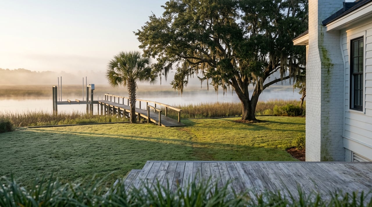
On Masonboro Sound, a property's frontage can face open water, a closed creek or a marina buffer, and that difference doesn't show up on a listing sheet. If you're thinking about what a particular stretch of Masonboro Loop shoreline gives you on the water, Rainey E Wallace can go through it with you, creek by creek. Let's Connect.
This article is general information, not legal, tax or financial advice. Consult a qualified professional about your situation.
Offering clients unmatched regional expertise, global network strength, and proven results. For a real estate experience driven by professionalism, clarity, and results, contact Rainey!
RAINEY WALLACE
1900 Eastwood Rd Ste 38 Wilmington, NC 28403